Tenerife is often associated with beaches, resorts, and Mount Teide. But if you head north, you’ll discover a very different side of the island—greener, quieter, and deeply connected to history and nature.
One of the most underrated places to experience this authentic Tenerife is Los Realejos, a municipality overlooking the Atlantic Ocean, home to banana plantations, dramatic cliffs, and the stunning Rambla de Castro coastal trail.
Where Is Los Realejos?
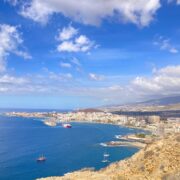
Los Realejos is located on the north coast of Tenerife, just west of Puerto de la Cruz and about 30 minutes from Santa Cruz de Tenerife. It stretches from the Atlantic coastline up into the green hills of the Orotava Valley, offering diverse landscapes within a single municipality.
Thanks to its northern location, Los Realejos enjoys:
- Lush vegetation year-round
- Cooler temperatures than the south
- Traditional Canarian atmosphere
- Fewer tourists compared to nearby Puerto de la Cruz
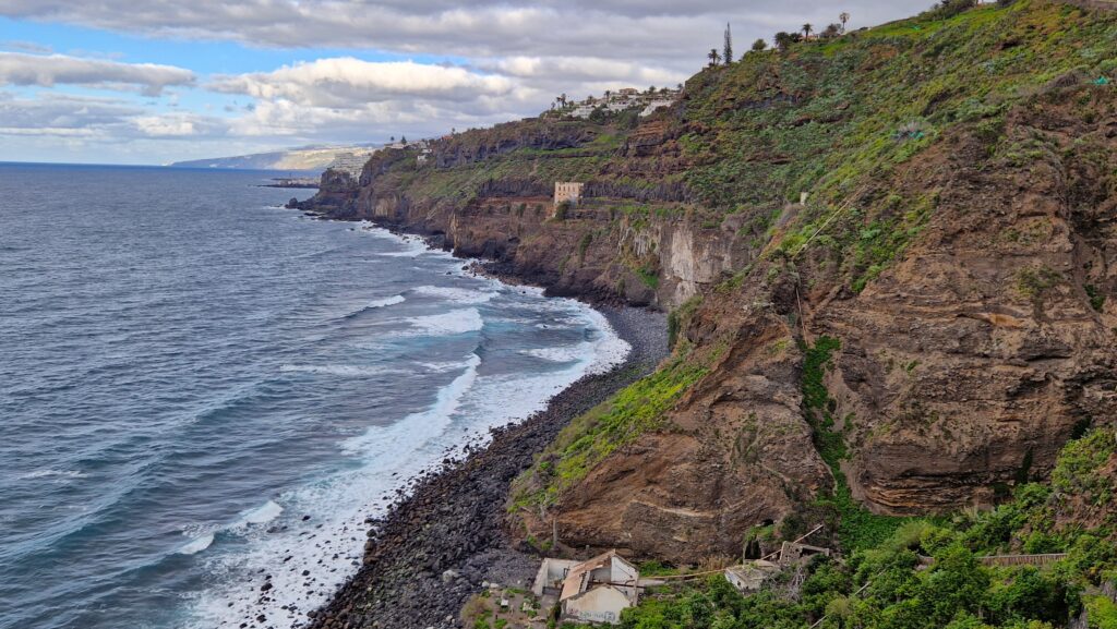
Rambla de Castro: One of the Most Scenic Walks in Northern Tenerife
Rambla de Castro is a protected natural area and coastal path that runs along the cliffs between Los Realejos and San Juan de la Rambla. It is considered one of the most beautiful coastal walks on Tenerife’s north coast.
This historic estate once belonged to wealthy landowners and still preserves remnants of old houses, water systems, and agricultural terraces—all set against the dramatic Atlantic coastline.
What You’ll See Along Rambla de Castro
Casa Hamilton / Elevador de Aguas de Gordejuela
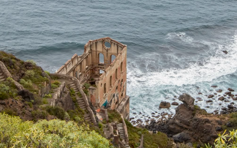
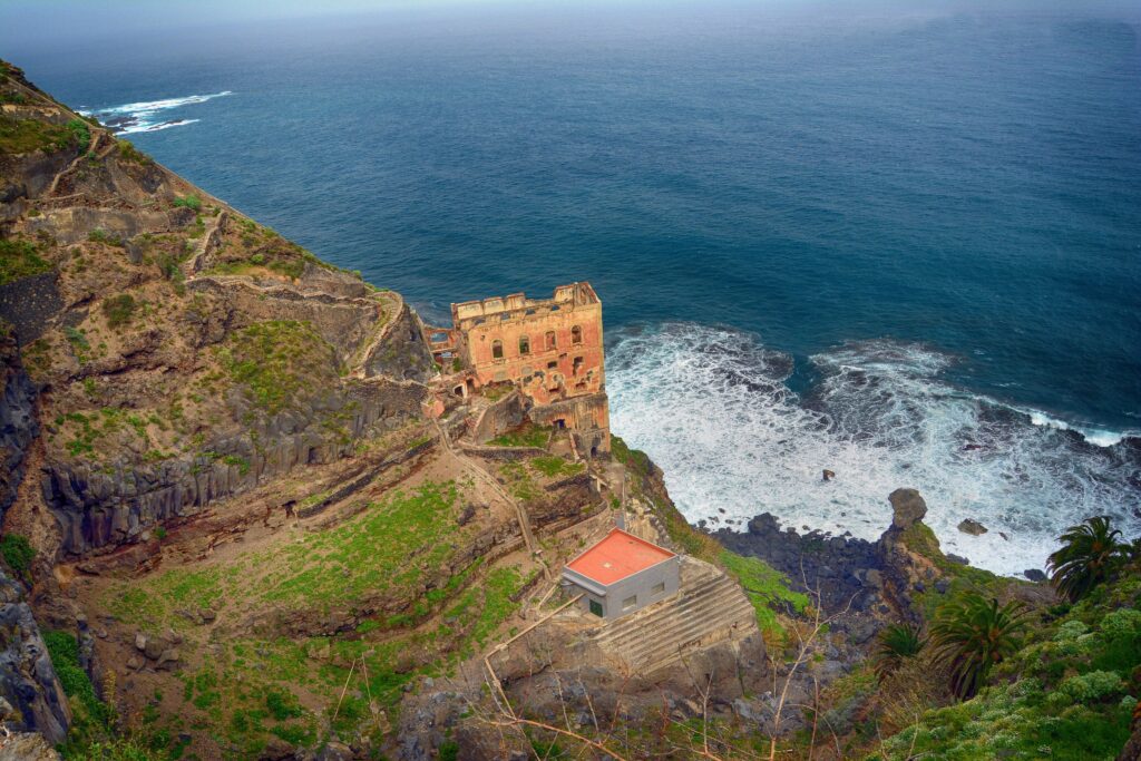
One of the most fascinating historical landmarks along the Rambla de Castro trail is Casa Hamilton, more formally known as the Elevador de Aguas de Gordejuela. This striking industrial ruin tells a story of early 20th-century innovation and Tenerife’s agricultural development.
Built in 1903 by the British Hamilton company, the structure served as a pumping station designed to lift fresh water from the Gordejuela springs up the steep coastal cliff to irrigate the banana plantations of the Orotava Valley and Realejo Alto.
At the time, it was a groundbreaking engineering feat:
- The system was powered by the first steam engine ever installed on Tenerife.
- Water was pumped up approximately 200 metres (660 ft) above sea level.
- From there, a 12-km aqueduct transported water to fields and farms.
Originally the complex included multiple buildings (boiler rooms, workers’ quarters, warehouse and a 43-metre chimney), but today only the dramatic skeletal remains survive, their empty windows framing the Atlantic Ocean.
Today, the Elevador de Aguas de Gordejuela is an eerie and photogenic ruin—a favourite stop for walkers and photographers on Rambla de Castro. While the interior is closed off for safety, the exterior alone conveys the ambition and history of Tenerife’s agricultural past.
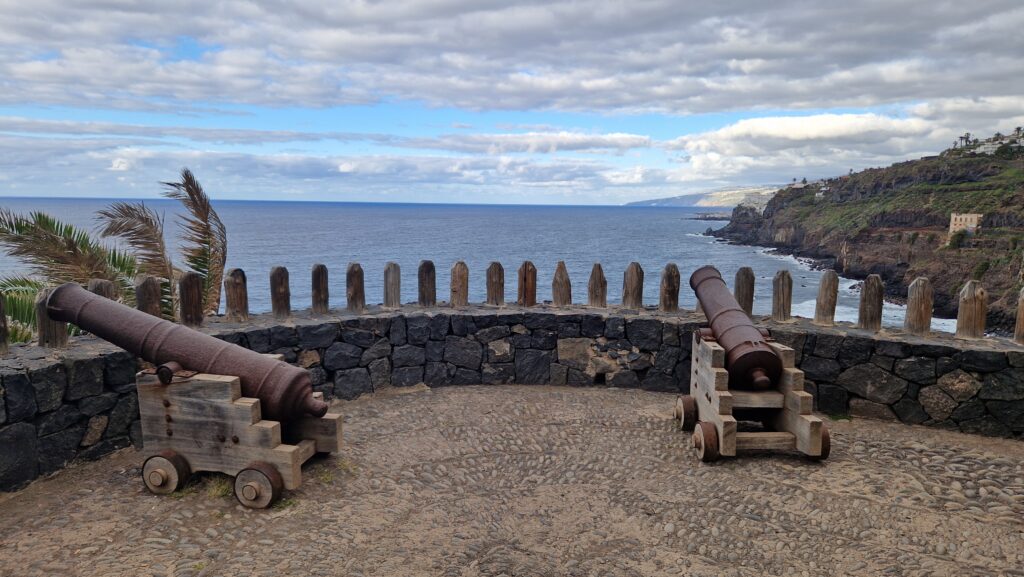
Fortín de San Fernando
Another important historical site along Rambla de Castro is the Fortín de San Fernando, a small coastal fortification hidden among vegetation near the cliffs.
This fort was built in the 18th century as part of Tenerife’s coastal defense system, designed to protect the island from pirate attacks and foreign naval threats, which were common during that period. Together with other forts along the north coast, it helped guard strategic landing points and agricultural estates.
Although only ruins remain today, the location of Fortín de San Fernando is impressive:
- Positioned above the Atlantic Ocean
- Offering wide views of the coastline
- Naturally camouflaged by palm trees and shrubs
The fort once housed cannons aimed directly at the sea, allowing defenders to monitor ships approaching the coast. Its modest size reflects its role as a support defense point, rather than a large military stronghold.
Today, the ruins add a strong sense of atmosphere to the walk. Standing here, it’s easy to imagine the strategic importance of this coastline centuries ago, when Tenerife was a key stop on Atlantic trade routes.
For history lovers, Fortín de San Fernando is one of the most fascinating hidden details along the Rambla de Castro trail—and a reminder that this peaceful path once played a role in protecting the island.
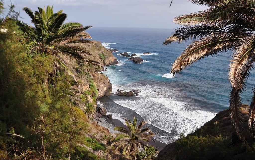
Playa de Castro and the Coastal Waterfall
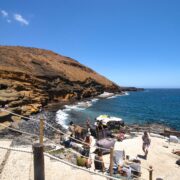
At the bottom of the cliffs below Rambla de Castro lies Playa de Castro, a small, wild beach framed by volcanic rock and lush greenery. Unlike the wide sandy beaches of southern Tenerife, Playa de Castro feels raw, secluded, and untouched.
One of its most distinctive features is the natural waterfall that flows directly down the cliff onto the rocks near the beach. This waterfall is fed by underground water channels and springs that once supplied the surrounding agricultural estates. During wetter months, the cascade becomes especially impressive, creating a rare sight on Tenerife’s coastline—fresh water meeting the Atlantic Ocean.
Swimming here is not recommended due to powerful currents and lack of lifeguard services, but the beach is a beautiful spot to admire from above or to visit carefully for photography and nature observation.
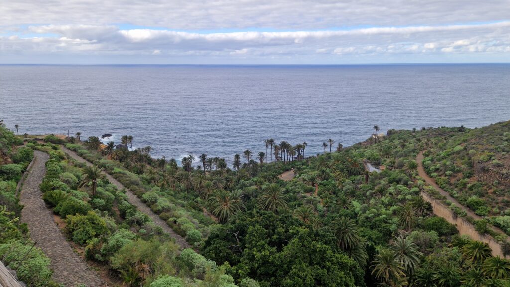
Palm Groves and Native Vegetation
Rambla de Castro is also botanically rich. Along the trail you’ll walk through:
- Canary Island palms
- Dragon trees
- Fig trees
- Coastal shrubs and endemic plants
This mix of greenery and ocean views makes the walk especially popular with photographers and nature lovers.
Rambla de Castro Walk: Practical Information
Trail Length and Difficulty
- Distance: approx. 4 km one way
- Difficulty: easy to moderate
- Suitable for: casual walkers, families with older children
Starting Points
- Mirador de San Pedro (most popular access)
OR
- near Plaza Las Rosas in Los Realejos
Best Time to Visit
- Morning or late afternoon
- Avoid rainy days (path can be slippery)
- Sunset offers spectacular light for photos
What Else to Do in Los Realejos
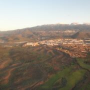
One of the greatest advantages of Los Realejos is its extraordinary vertical diversity. Within a single municipality, you can move from pine forests in the mountains, through traditional villages and farmland, all the way down to the raw Atlantic coastline. This makes Los Realejos an ideal destination for travelers who enjoy active exploration and varied landscapes.
Hiking in the Upper Parts of Los Realejos
The upper areas of Los Realejos connect directly to the Corona Forestal Natural Park, offering access to some of the most scenic hiking routes in northern Tenerife. These trails follow historic caminos reales (royal paths) once used by farmers and traders moving between the coast and the Orotava Valley.
Popular hikes lead through:
- Canary Island pine forests
- Old agricultural terraces
- Viewpoints overlooking the Orotava Valley and Mount Teide
Thanks to higher elevation, these routes are especially pleasant on warmer days and provide a quieter alternative to more famous hiking areas like Anaga.
Miradores and Panoramic Views
Los Realejos is dotted with viewpoints offering sweeping views of:
- The Atlantic Ocean
- Puerto de la Cruz
- The Orotava Valley
- Mount Teide on clear days
These miradores are perfect short stops when driving through the area or as destinations for shorter walks, especially around sunset.
Beaches and Wild Coastline of Los Realejos
Unlike resort towns, Los Realejos is defined by a natural, untamed coastline rather than classic sandy beaches. The coast here is dramatic and shaped by volcanic rock, strong waves, and steep cliffs.
Notable coastal spots include:
- Playa de Castro, a wild beach below Rambla de Castro
- Playa del Socorro, a well-known surfing beach popular with locals
- Rocky shorelines and natural pools (only safe in calm conditions)
While swimming is often limited by Atlantic currents, the coastline is ideal for coastal walks, photography, and experiencing Tenerife’s raw northern character.
Local Life, Food, and Authentic Atmosphere
Away from the coast and trails, Los Realejos remains a living Canarian town, not a tourist resort. Local restaurants and guachinches serve traditional dishes such as papas arrugadas, grilled meats, and local wine from the Orotava Valley.
Compared to more tourist-heavy areas, prices are lower and the atmosphere more relaxed, making Los Realejos a great base for slow travel and longer stays.
How to Combine Los Realejos With Other North Tenerife Spots
Los Realejos fits perfectly into a north Tenerife itinerary together with:
- Puerto de la Cruz
- La Orotava
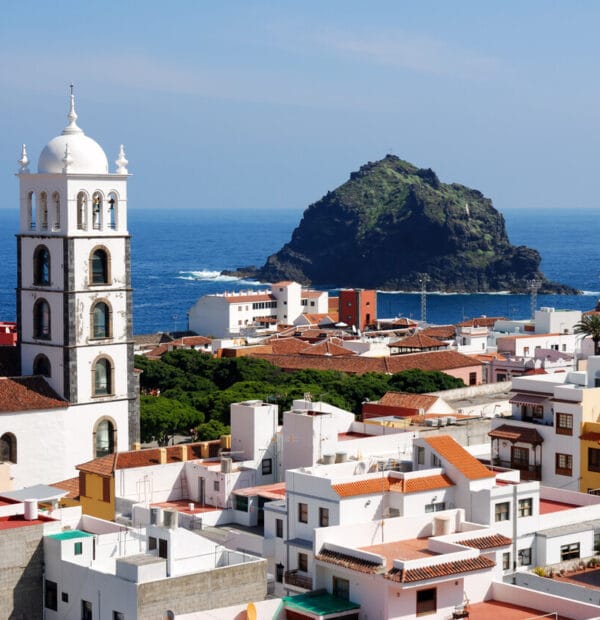
- Garachico
- San Juan de la Rambla
- Anaga Rural Park (as a longer day trip)
Frequently Asked Questions (FAQ)
Is Rambla de Castro suitable for families?
Yes, the trail is suitable for families with older children. However, supervision is needed near cliffs.
Can you swim along Rambla de Castro?
Swimming is not recommended due to strong currents and lack of safe access points.
How long does the Rambla de Castro walk take?
Around 1–1.5 hours at a relaxed pace, excluding photo stops.
Is Los Realejos touristy?
No, Los Realejos is much less touristy than nearby Puerto de la Cruz and offers a more local atmosphere.
Do you need a car to visit Los Realejos?
A car is recommended for flexibility, but buses connect Los Realejos with Puerto de la Cruz and Santa Cruz.